
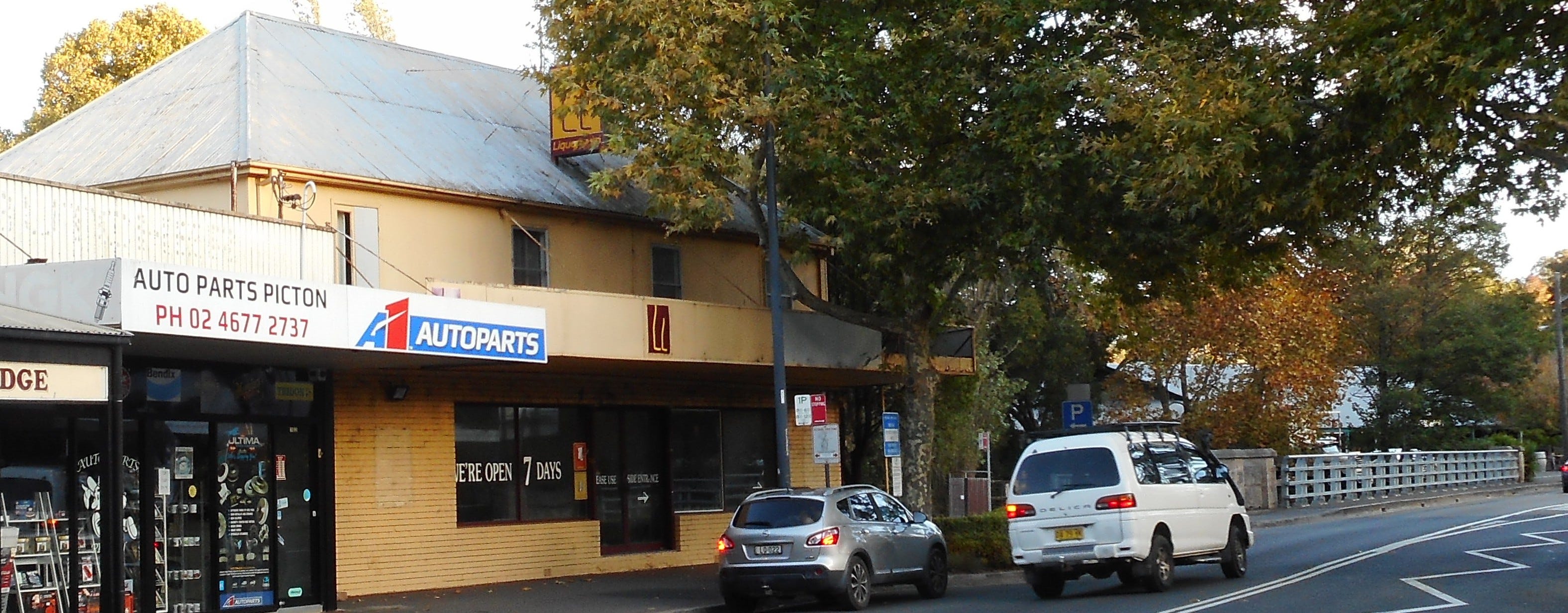
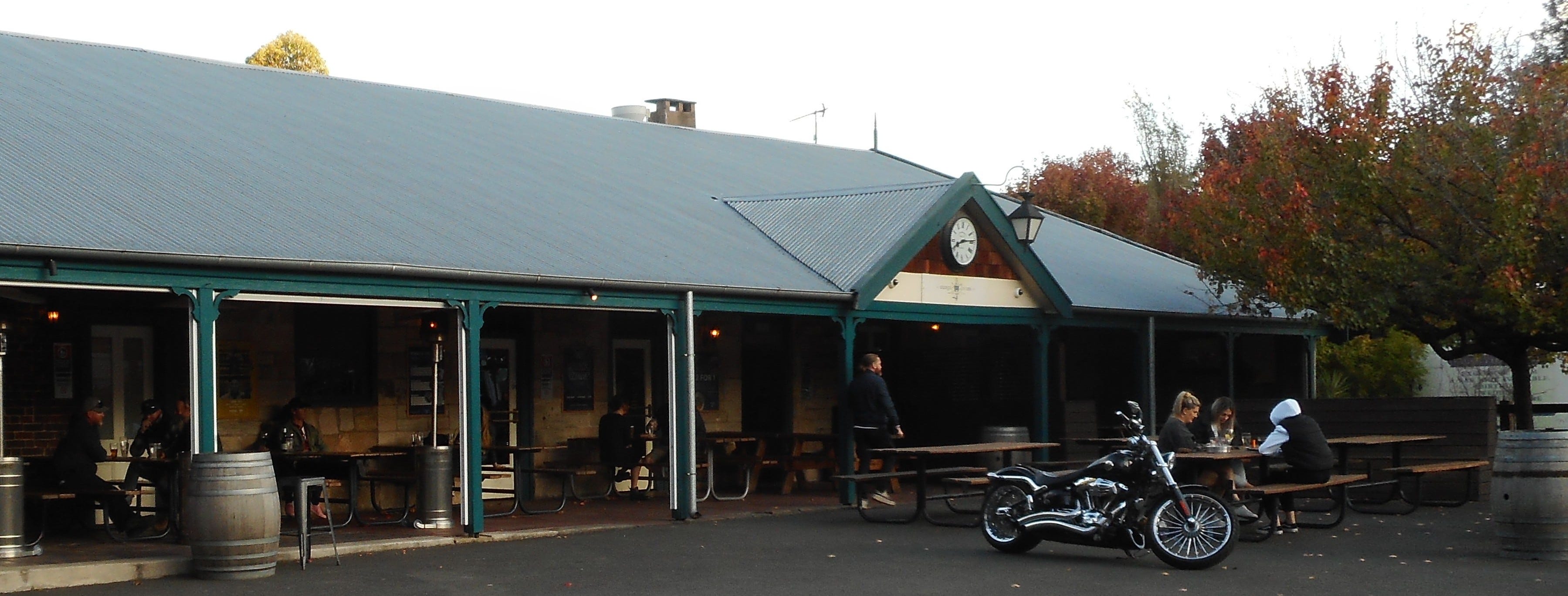
A Place Called Picton
Picton Workers Monument - 2

...it may be useful to think of places , not as areas on maps , but as constantly shifting articulations of social relations through time; and to think of particular attempts to characterise them as attempts to define, and claim coherence and a particular meaning for, specific envelopes of space-time.
Doreen Massey1
The starting point for this long overdue second installment of the Picton Workers Monument series was wondering what sort of place Picton was in the early 1860s, when William Hanham, Lewis Cragie and Thomas Gillingham came there to work.
Picton in the early 1860s was, of course, shaped by events in preceding decades. Delving into the newspaper articles, government records and local histories is an unsettling experience of confronting the mundane processes of colonisation – land grants, place names, buildings, roads and railways – that are so easy to ignore in daily life. At the same time, very little of the place itself comes through. Those records give little indication of the physicality of Picton for example, that it’s in a valley, surrounded in almost every direction by fairly decent hills. The records tell the story of the establishment and growth of a European settlement but say next to nothing about the place was like before that settlement. What did the First Australians - Dharawal and Gundungarra people - call this place? Was it a good place for finding food or other useful things? What types of birds and animals lived by the creek then? The picture of Picton in the past that can be recovered from these records is partial at best.
Doreen Massey argues that places hold multiple layers of meaning accumulated through interactions between people over time. How we understand the history of a place depends on the layers or interactions we decide to focus on from our perspective in the present.2 My focus is a story of particular settler activity – building a section of a railway line - in a place I know as Picton. This place simultaneously holds many other layers of meaning. For example, I am ignorant of the significance of the this place to First Australians, such as the Dharawal and Gundungarra people, in either the past or at present. But I know it had a name and a siginificance that runs alongside the story that I tell.
The establishment of a British penal colony at Sydney in 1788, and subsequent European settlement disturbed the processes of First Australian land and waterway custodianship around the place now known as Picton that shaped most aspects of life.3 In contrast, the incoming settlers assumed land was the property of the British Crown to be alienated and distributed at will.4 Granting land to private owners was central to the distribution of wealth in the new colony and consequently, the settler social hierarchy.5
In the early years of the colony, violent conflict over access to and control of the land ensured that European settlement stayed within the Sydney basin, bounded by the Nepean River.6 On the Sydney side of the Nepean river, land not required for penal operations was gradually surveyed and granted to settlers to farm, dispossessing the traditional Aboriginal custodians.7 On the other side of the Nepean River, including the area that is now Picton, there were incursions as settlers went exploring, chased wild cattle, cut down trees and made use of land for agricultural purposes but no officially endorsed, permanent, settlements.8
In 1815, Governor Macquarie was authorised to build a stockyard at Picton, then called Stone Quarry, as part of an operation to capture and tame large herds of wild cattle roaming the grasslands west of the Nepean River.9
In 1816, a military operation to confront and capture the Aboriginal warriors seen as the ringleaders of resistance culminated the massacre of Gundungarra and Dharawal men, women and children near Broughton Pass, about 20 kilometres east of present day Picton.10 These events were both a watershed for settler-Aboriginal conflict around the Sydney basin and devastating for the Dharawal population.11 Conflict continued for some months but the massacre and its aftermath marked a shift from active Aboriginal resistance to settlers in the Sydney area.12
The same year, Governor Macquarie ordered that a road be built south from Sydney, passing through Stone Quarry, to Goulburn.
Five years later in 1821, Governor Macquarie extended the area opened for permanent settlement beyond the Nepean river and into the area that is now Picton.13 Land on the northern side of Stonequarry Creek, which runs through the centre of contemporary Picton, was identified as the site for a village and included in lands granted to Major Henry Colden Antill in 1822.14 Antill, like many successful grantees, was appointed a local magistrate, and later superintendent of police. He operated a lock up for criminals and a post office on his grant, near Stonequarry Creek.15
In 1832 a settler visitor to the nascent Picton described the impact of colonising settlement on the land in this way:
The eye of the traveller...rests upon a most agreeable landscape; the space is confined, but every feature is complete. We must therefore pause a moment , and enquire how it is that the station known as Stonequarry Creek, where as late as 1824 was a wilderness, without habitation, bridge or road, thickly studded with gigantic timber and the central herding place for wild cattle; has undergone such a rapid transition.16
A few years later, another settler travelling through the area on the mail coach made the following description. ‘[W]e reached a little hamlet of about half a dozen huts, romantically placed in a hollow among the hills, called Stonequarry Creek’.17
In 1842, Major Antill subdivided some of his land at Stonequarry Creek to establish the village of Picton. Land on the other side of the creek occupied by his neighbour, George Harper, already offered an inn.18 Convict transportation had recently ended in NSW and around 70% of the settler population in areas like Stonequarry Creek comprised convicts, freed convicts and people born in the colony.19
Former convict, John Martin established a general store directly across Stonequarry Creek from the inn. Thomas Larkin, an immigrant from Sussex, England, operated a steam mill across the road from the general store next to the police lock up and in front of the land that would soon become St Mark’s church and cemetery.20 Both Larkin and Martin appear to have been active members of the St Mark’s congregation, once it was established.21
Picton benefited greatly from the increased traffic on the road south following the discovery of gold in southern NSW in the 1850s.22 By the mid-1850s, Lower Picton was a thriving settlement with ‘three inns, a butcher, stores…, a post office, wheelwright, blacksmiths’ miller, baker, doctor and builder’.23
This was more or less the place William Hanham, Thomas Gillingham and Lewis Cragie found when they arrived in Picton in the early 1860s. By this time there was a population of slightly under 400 men and women. Homes were mostly made of wood, and most of those in the workforce were skilled workers, professionals, government employees or engaged in commerce. Just over 50% of the population was born in NSW, a small number hailed from other Australian colonies and 44% orginated from England, Ireland or Scotland.24
I wonder, how did the massacre only twenty kilometres to the east influence the growing settlement and relations with First Australians? Here the settler records give only fleeting and frustrating glimpses.25 A census of First Australians taken in 1845 recorded 67 people living an increasingly precarious traditional life in the Picton area as access to land and resources steadily disappeared.26 Gundungarra man, Werriberrie, recalled that ‘[w]e were never interfered with on any property of the Antill family, which included all the Picton Valley’, suggesting that perhaps interference was experienced in other places.27
Mrs James Mann, born in 1846, recalled First Australians camping in the fields behind the inn at Tahmoor (about seven kilometers south of Picton) during her childhood.28 A newspaper records that in 1851, Charley and George from Picton, were ‘sent’ over to Appin to help a successful hunt for three missing children.29 This Charley may also be the Charlie of the couple, Mary and Charlie, ‘who for many years lived in and about the village of Picton’ until about 1865.30 And also perhaps also the ‘Cranky Charlie’ who worked at the mill from time to time and whose native name was recorded by William Russell ‘Werriberrie’ as Grumlin.31 And more intriguingly, perhaps the owner of the breastplate inscribed ‘Crambeloun Charley of Picton’ held in the Australian Museum collection.32
Despite the flourishing settlement, travel between Sydney and Picton cannot have been an easy journey. Convict labour turned the track between Stonequarry Creek and Camden to the north east in the first half of the 1830s. Travelling over Razorback mountain, the road is narrow, windy and very steep in places.33 Now mostly the domain of locals since the steepest parts were duplicated by a highway in the early twentieth century, this was once the main road south from Sydney through Camden and Picton to southern NSW. If William Hanham, Thomas Gillingham and Lewis Cragie travelled through Camden on their way to Picton to build the railway line, which is likely, this is the road they would have taken.
An anonymous (settler) correspondent out on a weekend jaunt in 1836 describes crossing the Nepean by coach and travelling over the Razorback ‘ a long steep hill, from the top of which we had a very beautiful and extensive view’ and a steep descent on the other side.34 Despite this rather positive description, complaints about its state of the road over the Razorback and south through Picton to southern NSW were frequent and continuous.35 James Bell, born in 1847 in Picton, recalls his father, the supervisor of road works between Camden (north of Picton) and Berrima (about 40 kilometres or 25 miles south of Picton), describing the Razorback as ‘a terror of all teamsters’ with many accidents and deaths of horses, bullocks and drivers.36 William Russell ‘Werriberrie’, similarly recalled bullock teams being killed on the Razorback by runaway wagons.37 There were also problems with flooding making the road impassable.38
By the 1860s though, things were changing again. The railway line from Sydney reached Picton in 1863, destined to continue southwards despite the hilly terrain, and at the same time significant work was going into improving the roads.39 William Hanham, Thomas Gillingham and Lewis Cragie were part of this process of change.
Endnotes
Doreen Massey, “Places and Their Pasts,” History Workshop Journal Spring, no. 39 (1995): 188, https://www.jstor.org/stable/4289361.
Massey, 188.
Heather Goodall, Invasion to Embassy: Land in Aboriginal Politics in New South Wales, 1770-1972 (St Leonards, NSW: Allen & Unwin, n.d.), 17.
Goodall, 38.
Goodall, 23, 38.
Bruce Watt, Dharawal the First Contact People: 250 Years of Black and White Relations, 2nd ed. ([New South Wales]: Bruce Watt, 2020), 42; Stephen Gapps, The Sydney Wars: Conflict in the Early Colony 1788-1817 (Sydney, NSW: NewSouth Publishing, 2018); Goodall, Invasion to Embassy: Land in Aboriginal Politics in New South Wales, 1770-1972, 23.
Goodall, Invasion to Embassy: Land in Aboriginal Politics in New South Wales, 1770-1972, 23; Les Bursill et al., Dharawal: The Story of the Dharawal Speaking People of Southern Sydney (Sydney: Kurranulla Aboriginal Corporation, 2007), 42; Watt, Dharawal the First Contact People: 250 Years of Black and White Relations, 2.
R. H. Cambage, “Exploration beyond the Upper Nepean in 1798,” Journal of the Royal Australian Historical Society 6, no. 1: 1–36, accessed March 17, 2023, https://nla.gov.au/nla.obj-593173270; James Jervis, “Settlement in the Picton and The Oaks District,” The Australian Historical Society: Journal and Proceedings 27, no. 4 (1941): 276–77, https://nla.gov.au/nla.obj-602181582; Rev. James Steele, “Early Days of Picton (1),” Journal of the Royal Australian Historical Society 1, no. 8 (April 1903): 156, https://nla.gov.au/nla.obj-590579571; Specifically in relation to Picton, Villy records the crossing at Stonequarry Creek was used by drovers as a resting and watering place, particularly after the road south to Goulburn opened in 1819. Elizabeth Villy, The Old Razorback Road: Life on the Great South Road between Camden and Picton 1830-1930 (Dural, New South Wales: Rosenberg, 2011), 135; F. J. Campbell, “The Wild Cattle of the Cowpastures, and the Village of Cawdor,” Journal and Proceedings, Royal Australian Historical Society 14, no. 1 (n.d.): 48.
Campbell, “The Wild Cattle of the Cowpastures, and the Village of Cawdor,” 48.
Grace Karskens, “Appin Massacre,” The Dictionary of Sydney, 2015, https://dictionaryofsydney.org/entry/appin_massacre; Gapps, The Sydney Wars: Conflict in the Early Colony 1788-1817, 240–55; Goodall, Invasion to Embassy: Land in Aboriginal Politics in New South Wales, 1770-1972, 27–29; Carol Liston, “The Dharawal and Gandangara in Colonial Campbelltown, New South Wales, 1788-1830,” Aboriginal History 12, no. 1/2 (1988): 51–55, http://www.jstor.org/stable/24045667; For accounts from an Aboriginal perspective see A Declaration of War: Gavin Andrews, A History of Aboriginal Sydney: Video Gallery, accessed May 7, 2023, https://historyofaboriginalsydney.edu.au/south-west/declaration-war-gavin-andrews; Appin Massacre - April 1816: Frances Bodkin, A History of Aboriginal Sydney: Video Gallery, accessed May 7, 2023, https://historyofaboriginalsydney.edu.au/south-west/appin-massacre-april-1816-frances-bodkin; Appin Massacre Remains: Glenda Chalker, A History of Aboriginal Sydney: Video Gallery, accessed May 7, 2023, https://historyofaboriginalsydney.edu.au/south-west/appin-massacre-remains-glenda-chalker.
Bursill et al., Dharawal: The Story of the Dharawal Speaking People of Southern Sydney, 45.
Gapps, The Sydney Wars: Conflict in the Early Colony 1788-1817, 252–53.
Jervis, “Settlement in the Picton and The Oaks District,” 278–79.
Jervis, 284.
J. M. Antill, “Antill, Henry Colden (1779–1852),” in Australian Dictionary of Biography, 18 vols. (Canberra: National Centre of Biography, Australian National University), accessed July 2, 2023, https://adb.anu.edu.au/biography/antill-henry-colden-1710; Villy, The Old Razorback Road, 66.
Jervis, “Settlement in the Picton and The Oaks District,” 284 Citing a letter published in the Sydney Gazette, April 26, 1832.
“Rough Notes of Rough Rides in New South Wales,” Australian, March 29, 1836, 4, http://nla.gov.au/nla.news-article36856680.
Villy, The Old Razorback Road, 138.
Russel Ward, The Australian Legend, 2nd ed. (Melbourne: Oxford University Press, 1966), 94.
Villy, The Old Razorback Road, 139–40; Jervis, “Settlement in the Picton and The Oaks District,” 286; James Bell, “History of Picton,” Australian Historical Society: Journal and Proceedings 8, no. Supplement (1923): 376, https://nla.gov.au/nla.obj-595021899.
“Picton,” Empire, May 8, 1865, 5, http://nla.gov.au/nla.news-article64137860.
Villy, The Old Razorback Road, 167.
Villy, 142.
Registrar General (NSW) and Australian Bureau of Statistics, NSW Census 1861, 1862, http://archive.org/details/nsw-census-1861.
Michael Organ, “Illawarra and South Coast Aborigines 1770-1850,” University of Wollongong Research Publications, January 1, 1990, 275, https://ro.uow.edu.au/uowbooks/7.
Organ, 292.
William Russell “Werriberrie,” My Recollections (Camden, 1914), 12, https://nla.gov.au/nla.obj-520883949.
Mrs James Mann, “‘Tahmoor Park House,’ near Picton,” Journal of the Royal Australian Historical Society 23, no. Supplement (1923): 386, https://nla.gov.au/nla.obj-595021899.
“Appin,” Freeman’s Journal, October 2, 1851, 11, http://nla.gov.au/nla.news-article115766134.
“An Aboriginal Prisoner,” Empire, March 15, 1865, 5, http://nla.gov.au/nla.news-article60567639.
Villy, The Old Razorback Road, 143; Russell “Werriberrie,” My Recollections, 13.
Jakelin Troy, “National Museum of Australia - Other Aboriginal Breastplates,” National Museum of Australia (National Museum of Australia; c=AU; o=Commonwealth of Australia; ou=National Museum of Australia), accessed May 31, 2023, https://www.nma.gov.au/explore/features/aboriginal-breastplates/list/other.
The road was clearly in poor condition in 1832 but was suitable for wheeled vehicles in 1836. A convict bridge party was already stationed at Razorback in 1833, suggesting an intention to improve the traveling conditions. “THE RAZOR-BACK ROAD.,” Sydney Gazette and New South Wales Advertiser, March 3, 1832, 3, http://nla.gov.au/nla.news-article2205319; “Government Gazette Notices,” New South Wales Government Gazette, January 9, 1833, 18, http://nla.gov.au/nla.news-article230389605; “Rough Notes of Rough Rides in New South Wales,” 4.
“Rough Notes of Rough Rides in New South Wales,” 4.
Villy, The Old Razorback Road, 147–48.
Bell, “History of Picton,” 377.
Russell “Werriberrie,” My Recollections, 12.
Bell, “History of Picton,” 377.
“Construction and Maintenance of the Great Southern Road,” New South Wales Government Gazette, March 13, 1860, 513, http://nla.gov.au/nla.news-article230040779; Bell, “History of Picton,” 377; George A. Gilder, “The Early History of the Railways of New South Wales,” The Australian Historical Society: Journal and Proceedings 17, no. 4 (1931): 231, https://nla.gov.au:443/tarkine/nla.obj-598841425.